Warning: ini_get_all() has been disabled for security reasons in /smarthosting/content/d/dodsonbeau/.website15332/wp-includes/load.php on line 1020

Warning: ini_get_all() has been disabled for security reasons in /smarthosting/content/d/dodsonbeau/.website15332/wp-includes/load.php on line 1020
Beau's Journey

April 22, 2009: Putting up swing – chain sawing – thermometers

  Well, today  has been a long day.  Spent it up at the farm – cut a bunch of brush – then installed the thermometers into the instruments shelter – then we hung a swing.  Rodney, Bobby, and Don built a house.  🙂  Looks like the rafters are coming along.  They also delivered the posts today for the decks/porches. 

  I had a great lunch with Caesar and Geri yesterday.  We all went to CC Cohen (downtown Paducah).  We had to fight off the quilters, though.  Okay, well it wasn’t THAT bad.  But, there were a lot of quilters around!

  BEAUTIFUL sunny day today.  Perfect temperatures – 70s!!!!  One of the rare 70+ days this year so far.  We could use a few more.  It looks like great weather through Sunday.  Might get some rain after that, though.  Hopefully the good weather will continue.  It is spring, though.  So, it won’t last forever. 

  Some photos from yesterday and today.


I won this on ebay today – one of the first weather radios I ever owned!  I
saw one in Oklahoma at the Severe Wx Conference and it gave me the
idea to do a search for one.  I was about 12 when I got my first weather
radio and it came from Sears!


Looking at the new house from where my grandmothers house used to be – this is the old well


Beautiful cumulus and cirrus clouds yesterday – going up I24 in Massac County, Illinois


Puffy clouds over the Ohio River


Looking towards Metropolis yesterday.  Windy windy – white caps.


Looking down towards the neighbors farm – west/northwest


Rodney and Bobby


Rodney


Putting the swing together


That would be me – getting ready to hang the swing


That would be me – climbing the ladder and getting ready to hang the swing


And the final product 🙂 – Now I just need some bolt cutters to cut the extra chain.  🙂  Perhaps tomorrow!!!


The neighbors dog sound asleep – helping with the swing


We got the door to close and lock today – tornado shelter


On the third floor – top of the house.


Looking southwest from the top of the house (well almost the top)


Some spring flowers up on the farm


Time to put the thermometer together 🙂  –  This is the device the holds them in place


The minimum thermometer is on the left and the maximum one is on the right


Then they are placed inside the shelter


Now if I can just figure out how to read the maximum thermo – hard to read
(will need to ask my friend David Brown) from Canada.


April 20, 2009: SUNNY Morning! Then it rained.

  Well, it was a BEAUTIFUL start to the morning.  INCREDIBLE to be honest about it.  Just perfect.  By afternoon clouds rolled in and it started to lightning and thunder – with heavy downpours.  Oh well, the morning was nice!  Course – I like rain – so whatever.

  I have come to the realization that I am just not a phone person.  I know Sue told me this a long time ago.  Oh well – guess everyone can’t be a phone person!  I will just have to try harder.  🙂

  We met Dale at the farm today and went over the cabinets and placement of cabinets.  Also discussed a few other items.  Looks like everything is moving right along.

  Some photos from the farm today…you can see the sheets of rain moving in.  Note that when we arrive it is PERFECTLY sunny and within 30 minutes the sky turns to what you see at the end.


We arrive and it is a perfect day!!!!


Then a few clouds show up and the wind starts to blow


Then a few more clouds and some rain in the distance


Sheets of wind blown rain – winds were gusting over 30 mph as we drove down the road into the rain.


April 20, 2009: Busy days!

  WOW – the sun is actually out this morning.  BRIGHT blue sky!  Big orange ball – plain as day!  Something we don’t see very often around here.  At least not lately.

  Enjoy it!!!!!

  Few storms later today and then the winds will pick up through tomorrow.  Could be some hailers out and about – small hail.  Cold temperatures aloft this afternoon.

  Tony is coming this morning and we are looking at some apartments – also heading to the farm to meet Dale – who is making the cabinets.  Then figuring out where the plumbing goes!  Also talking about the kids room on the top floor – how to finish it out.

  Then home and I guess I will start to study some more for my finals.  I have finals through the weekend.  FUN FUN!  lol

  Lunch with Caesar and Geri tomorrow. 


April 19, 2009: Storms rolling into the region…

  Lines of showers and thunderstorms are approaching West Kentucky.  No severe weather has been reported.  A severe thunderstorm watch was in effect for portions of southeast Missouri, Arkansas, and Tennessee.  Looks mainly like some heavy rain, gusty winds, and small hail. 


Stormy sky over Paducah – 5 PM

April 19, 2009: Teardrops from Heaven

  I took this photo of a raindrop earlier this afternoon clinging to a flower petal.  You can see the cumulus clouds and blue sky reflected in the raindrop. 


Teardrops


April 19, 2009: Spring Wasp

  I miss taking "photographs".  🙁  Life will slow down a bit later this year 🙂 – school will be finished and the house will be built.  Then perhaps I can concentrate a bit more of taking photographs – once again.

  The sun popped out this afternoon and there are plenty of flowers blooming – everywhere.  Puffy Cumulus Clouds dot the sky.  I took these photos of a wasp outside of the house on one of our flowery bushes…


Grace


April 19, 2009: Rain Rain Rain Rain Thunder

  Well, the clap of thunder woke Daisy and me up this morning.  She jumped straight up out of bed – so I had to grab her and hold onto her.  lol  There was a loud clap of thunder then another.  You could hear the rain hitting the windows of the house here in Lone Oak.  Woke up this morning and it was still raining.  Looks like a lot of water in the ditches.  Rain should continue through today and into this evening.  Strong storms are possible if the sun can come out later (heat things up and provide more energy for the atmosphere).

  We are nearing the 1" mark for rainfall since Midnight.


Morning radar showing widespread rain

April 19, 2009: Strong storms possible today…

Date: Sunday, April 19, 2009

Call to action: Spotters activation may be required later this morning and into the afternoon hours.

This forecast was issued by – Beau Dodson
Meteorological Specialist for the Paducah/McCracken County Office of Emergency Management

This outlook is issued for portions of southeast Missouri, South Illinois, southwest Indiana, State of Kentucky, West Tennessee, and northeast Arkansas.
Effective from .

Weather Event/Threats: Strong to possible severe thunderstorms later this morning and afternoon.

Storm Mode/Type:  Thunderstorms will form if the sun comes out later this morning and into the afternoon hours.  Wind fields are weak but colder air aloft will help trigger strong/severe storms.  Large hail and gusty winds will be the main threat.  Isolated tornadoes will be possible.  SPC has placed us in a slight risk for today.

Storm Movement: East/Northeast 30+ mph
Storm Prediction Center Risk Level: Slight – (remember there are three levels of risk – slight/moderate/high).

Area impacted:  Entire region is under a risk for severe thunderstorms.

As always, severe weather events are normally isolated.  One county may receive severe storms while the county next to it escapes with very little in the way of significant weather.  This is the nature of severe weather.  As always, it is also impossible to forecast what county will receive what type of severe weather.  So, those with an interest in this storm system or concerned about the severe weather potential should listen to NOAA weather radio and local media for later statements and the possibility of watches and/or warnings.

Paducah’s hazardous weather outlook can be read at the bottom of the email.

Storm Prediction Center
http://www.spc.noaa.gov/products/outlook/

NWS Paducah (radar/warnings)
http://www.crh.noaa.gov/pah/

NWS Jackson, KY (radar/warnings)
http://www.crh.noaa.gov/jkl/

NWS Louisville (radar/warnings)
http://www.crh.noaa.gov/lmk/

NWS Memphis (radar/warnings)
http://www.srh.noaa.gov/meg/

NWS St Louis (radar/warnings)
http://www.crh.noaa.gov/lsx/

Large Radar
http://radar.weather.gov/Conus/full.php

Beau Dodson
Meteorological Specialist for the Paducah/McCracken County Office of Emergency Management

NWS HAZARDOUS WEATHER OUTLOOK
ISSUED BY THE PADUCAH, KY NWS OFFICE
http://kamala.cod.edu/ky/latest.flus43.KPAH.html

April 18, 2009: Daisy –

  Had a nice dinner with Tommy and Dione tonight.  We went down to Murray – new place I have never been to before called Tom’s Grill.  Great food 🙂  –  will defin go back.

  Afterwards Tommy took me to see a nice house on KY Lake.  Log cabin style – we even saw some deer!!!

  Doug says we are building the "10th Wonder of the Weather World" up on the farm!!!!  I like the sound of that.  🙂

  Daisy tonight seems fairly uninterested in the weather.  🙂

|
Daisy tonight 🙂  – now let’s compare with when we first got Daisy 🙂


Daisy in 2006

April 18, 2009: Raining – cloudy – a tall roof :)

  Well, we had some problems with the pitch of the roof last week, but those have been corrected today.  Looks like everyone agrees that this pitch is much better.  It is way up there, though.  I believe the observation deck is going to be more than 40 feet high.  So, a good view – for sure!!!!

  It is raining today – more rain tonight and Sunday.  Don’t think the severe weather risk is very high, though.  Can’t rule out a few strong storms, however.

  Some photos from earlier this afternoon –


Ladder going up 🙂


Looking southwest


The roof – first two sections were placed today.


April 16, 2009: Cloudy day! Tests! House coming along

  Well, it was supposed to be sunny today.  That did not happen.  Clouds have lingered for 90% of the day.  The sun is just now breaking through – evening.  Too little too late!  Maybe tomorrow?  Looks like it.  I am HOPING we have more sun than clouds for Friday.  Rain by Saturday and Sunday – Monday, as well.

  Tests!  I have my fourth quarter test today and tomorrow for Severe Weather and then finals.  Lots to study in the coming days.

  Jason, from St Louis, is coming tomorrow to put the pole into the ground for the solar panels.  Yay.  🙂  Then Sat and Sunday will be spent studying – then on Monday we are looking at some apartments in Paducah and revisiting the Murray subject – then to the farm to meet the man who is making our cabinets.  So, busy days ahead.  What is new?  🙂  I like it busy, though. 

  The roof is beginning to take shape.  We realized last night that the pitch was not correct – so they are going to change that.  Means a higher roof and widows walk – so I won’t complain about that!

  Some photos from today…


HIGH UP ON THE MOUNTAIN TOP 🙂


Bobby and Rodney discussing the roof


And finally the rain gauge for the Wunderground Instruments (online set) is now finished.  I believe we are
ready to go!  I need internet and electricity.  🙂  Soon – very soon 🙂 🙂 🙂


Do you think it has been cold lately?  You are correct!  A chilly spring.


April 15, 2009: Finishing weather instruments – found a room – getting taller

  Well, it was a fairly long day up at the farm.  Arrived this morning and starting running wires (electric) for the weather instruments and tower cam.  At one point I lost my pull string – but somehow managed to get it back.  I was fairly panicked for about 10 minutes!!!  Thankfully, I somehow managed to get it back and finished that project.  Now we have to hook it all up (waiting for electric to be run and T line).

  The roof is starting to go up on the house.  I went up into the room above the media room – which is/was the attic area.  However, the stairs that go to the top of the house (widow’s walk) is going to be in a small room at the top of the second set of stairs.  Anyway, Bobby and Rodney discovered that there will actually be quite a bit of room up there – so we have figued out where to put the kids video games and the like.  Which is good news, because this is something we had not quite figured out.  So, I am happy about that!

  The guy who is making the wood floors met Tony and the rest of us up there this morning, as well.  He is making them out of torn down barnwood.  Should be interesting :).  Hopefully I can get a photo of the barns they use.

  Tomorrow we have to finish up a few small items – on the weather instruments.  Attach a rain gauge.  Then I have finals coming up – so study study study for the weekend.

  Next chance of rain comes on Saturday and Sunday.  Don’t believe severe weather is in the cards.  Will keep an eye, though.  This time of the year it doesn’t take much instability to cause problems.

  Some photos from today…


Finished the big rain gauge 🙂 – it is ready to use.  Now we need rain – errr wait we don’t want rain.


Posting this for Jason to see – the wires are ready to hook up now for the weather instruments.


Starting to work on the roof 🙂


April 14, 2009: Quiet weather – mixing concrete – weather instruments

  Well, some quiet weather for a few days?  SAY IT ISN’T SO!!!!  🙂  Chilly weather today with a lot of clouds.  We escaped the severe weather threat yesterday.  Why?  No instability.  No instability = no severe weather.  Had the sun came out yesterday we would have had hailstorms and high winds.  Thankfully, we did not!  So, we escaped severe weather for once.

  Next threat for showers and storms will be Saturday or Sunday.  Nothing major – at least that is how it appears right now.  Will monitor 🙂  – as always.

  Finals are coming up.  Guess I need to start studying for those.

  We mixed concrete today.  Trying to get my weather instruments up and running.  I needed a concrete pad for the big rain gauge – then we put a pole in the ground for the digital rain gauge that shows up online – and we poured some concrete into the shelter leg – holes.  Will let it harden tonight and go check it tomorrow. 

  I need to run some electric wires – as well. 

  Verizon came today, but couldn’t finish.  They have to do a dig order – first.  I don’t know why they thought they could run the wire above ground.  The trucks will run over it.  That would not be good.

  Some photos from today…


Time to mix some concrete 🙂


April 13, 2009: Severe weather threat – mainly east of us – Easter Photos

  Well, too many clouds today to have severe weather.  Instability is better to our east and that is where I believe the most intense weather will remain.  Some hail is possible if storms can form this evening over southeast Missouri and South Illinois – they will then move eastward.  Again, though, the most intense weather will be to our east.  Tornado threat over portions of Indiana and Kentucky – then southward (east of Paducah, though).

  We had quite a bit of rain overnight.  Tony and I went up to the farm this morning and swept all the water out of the house.  Hopefully they will get things in the dry soon.

  Here are a few pictures from Easter.  We spent the evening at Tony and Deena’s house.  Had some great BBQ and played a few games.  The kids had an Easter Egg Hunt.  Even the big "kids" participated.  🙂


Tyler – Easter 2009


Deena and Tyler


Dylan and his girlfriend Shawnie


Lori made an easter brownie 🙂 


Danielle – with lots and lots of eggs!


Tyler – I think that is plenty of candy!


Bubba decided to participate in the hunt.


Farm this morning – stormy sky. 


Looks like the garage roof is coming along.

April 12, 2009: Made the front page – severe weather moving into region – again

  The recent storms have brought some attention from the media, again.  There was a nice front page article about all of the tornadoes and recent hail/wind events.  Here is the story from the Paducah Sun – http://www.stormreports.org/april112009_frontpage.htm 

  They had a quote from me concerning the high winds in McCracken and Massac Counties.  I tried my best to get Tony’s hail photo included!  No luck this time around.  I guess he will just have to chase again.

  Here is some images I put together of the Massac County event – http://www.stormreports.org/april_10_2009_massacstorm.htm

  More strong to severe weather will be possible on Monday.  Hail could be a problem.

  Regional radar at 10 AM this morning –


April 12, 2009: Severe weather possible on Monday

Date: April 11, 2009

Couple of items –

We have yet to have a "major" outbreak.  All of the risks lately have been slight.  This shows you what the potential for each "risk" level is from the Storm Prediction Center (there are three – slight/moderate/high).  Don’t be fooled by the terminology of "slight" risk (I don’t care for their threat levels anyway – it is confusing and can be misleading).

Also – I have discovered that it is not productive for me to send out watch alerts and warnings – my time needs to be focused on radar coverage for emergency management.  So, if you want to receive watches and warnings – please go here (it is a free service and I use it, as well)

WPSD TV 6 Email Weather Alerts:  http://www.wpsdlocal6.com/login.aspx?ReturnUrl=%2falertregistration%2fdefault.aspx

Also, I recommend everyone have a NOAA Weather Radio – it is the quickest way to receive warnings.

I will continue to send out daily forecasts when weather events are expected.  I will also update the outlooks as necessary.  Since Jan/Feb the email updates have been averaging a lead-time of 5-7 days on each event.  But, like this morning – the weather can be unpredictable at times.  Storm systems can slow down and surprise us with more severe weather or less severe weather than expected.

Also, I always encourage everyone to remember that when a severe weather event occurs not every county will receive severe weather.  Remember, that this email is going out to numerous counties.  Listen for watches and specific county warnings from NOAA Weather Radio or local media.

Now for the forecast…


Call to action: Spotter activation might be necessary on Monday.  As always, listen to NOAA Weather Radio or other local media for updated forecasts.

This forecast was issued by – Beau Dodson
Meteorological Specialist for the Paducah/McCracken County Office of Emergency Management

This outlook is issued for portions of southeast Missouri, South Illinois, southwest Indiana, State of Kentucky, West Tennessee, and northeast Arkansas.
Effective from .

Weather Event/Threats: Heavy rain and possibly strong/severe weather
Heavy Rain – Sunday night into Monday
Strong/Severe Thunderstorms – possible on Monday

Storm Mode/Type: Possible bow echoes and supercells in or near the region

Storm Prediction Center Forecast Threat Level: Slight  (Remember there are three levels – slight/moderate/high).

Storm Movement: East/Northeast 30+ mph

Area impacted:  Entire region

Discussion:  Yet another in a series of strong storm systems will approach the region on Sunday night and Monday.  It is a bit early to know for sure just how high the risk for severe weather will be.  At this time the models are showing a window of opportunity for severe weather from noon Monday through 9 PM.  This is still a couple of days away and will need to be monitored.

Heavy rain is going to be a problem.  Recent moderate to heavy rain events have caused rivers to rise.  This is going to continue.  Additional rainfall could cause flash flooding or general flooding in some of our counties.  We will need to monitor this situation, as well.  Those interested in river levels and flood potential should visit the Paducah, NWS web-site for updated flood information.

Rain will move into our region on Sunday night and continue into Monday morning.  We should have some sort of break on Monday morning – late.  More rain and thunderstorms are then forecast to develop over the region as the warm front moves northward.  If the storm system tracks further south and east then the severe weather threat level will be lower.  Again, updated forecasts will fine tune the threat.

Looking ahead – more showers and thunderstorms are possible later this week.  I know it is beginning to sound like a broken record.  Spring is here.

Beau Dodson
Meteorological Specialist for the Paducah/McCracken County Office of Emergency Management

Links of interest:

Storm Prediction Center
http://www.spc.noaa.gov/products/outlook/

NWS Paducah (radar/warnings)
http://www.crh.noaa.gov/pah/

NWS Jackson, KY (radar/warnings)
http://www.crh.noaa.gov/jkl/

NWS Louisville (radar/warnings)
http://www.crh.noaa.gov/lmk/

NWS Memphis (radar/warnings)
http://www.srh.noaa.gov/meg/

NWS St Louis (radar/warnings)
http://www.crh.noaa.gov/lsx/

Large Radar
http://radar.weather.gov/Conus/full.php

NWS HAZARDOUS WEATHER OUTLOOK
ISSUED BY THE PADUCAH, KY NWS OFFICE
http://kamala.cod.edu/ky/latest.flus43.KPAH.html

April 11, 2009: Tornado hits Calloway County, KY – Massac County Damage

  More damage information from April 10th.  Calloway County was hit by a tornado.  Right by Joey’s parents.  We called and warned them.  They didn’t see the tornado.  Damage was a couple of miles from them.

PUBLIC INFORMATION STATEMENT

NATIONAL WEATHER SERVICE PADUCAH KY

355 PM CDT SAT APR 11 2009

…DAMAGE SURVEY RESULTS FOR CALLOWAY COUNTY KENTUCKY…

THE FOLLOWING IS A PRELIMINARY DAMAGE ASSESSMENT FOR DAMAGE THAT OCCURRED IN NORTHERN CALLOWAY COUNTY ON FRIDAY APRIL 10TH 2009.

THE DAMAGE PATH INCLUDES A MICROBURST PATH AND WITHIN THAT PATH WAS INCLUDED A BRIEF EF0 TORNADO.

THE TORNADO PATH SURVEYED:
* EVENT TIME – ESTIMATED 1116 AM CDT TO 1118 AM CDT
* EVENT TYPE – EF0 TORNADO

* EVENT LOCATION – BEGAN 3.5 MILES SOUTHWEST OF DEXTER AND   LIFTED 3.25 MILES SOUTHWEST OF DEXTER. OR NEAR 2635 HIGHWAY 464
 AND LIFTED NEAR 2392 HIGHWAY 464.
* PEAK WIND – 85 MPH

* AVERAGE PATH WIDTH – 75 YARDS

* PATH LENGTH – ONE QUARTER OF A MILE

* INJURIES – NONE

* DAMAGE – SEVERAL HOMES WITH SHINGLES AND SIDING OFF AND SOME LIGHT STRUCTURAL DAMAGE. SEVERAL STORAGE BUILDINGS DESTROYED. DOZENS OF TREES UPROOTED OR BROKEN OFF.

DOWNBURST SURVEYED:

* EVENT TIME – ESTIMATED 1115 AM CDT TO 1120 AM CDT

* EVENT TYPE – MICROBURST

* EVENT LOCATION –  BEGAN 4 MILES SOUTHWEST OF DEXTER AND ENDED 2
 MILES SOUTHWEST OF DEXTER. THE DAMAGE STARTED AT 2913 HIGHWAY
 464 AND ENDED NEAR 531 HICKORY GROVE ROAD.

* PEAK WIND – 70 MPH

* AVERAGE WIDTH – 100 YARDS

* PATH LENGTH – 2 MILES

* INJURIES – NONE

* DAMAGE – DOZENS OF HOUSES WITH SHINGLE AND MINOR SIDING DAMAGE.
 MOBILE HOME BLOWN OVER ON ITS SIDE. HALF A DOZEN BARNS WITH ROOF
 DAMAGE. THE EF0 TORNADO ALSO OCCURRED IN THE PATH OF THIS
 DOWNBURST.

$$


MAP OF THE TORNADOE’S PATH – CALLOWAY COUNTY, KENTUCKY

Radar grabs from the storm – we were watching it when it hit and Joey was on the phone with his parents warning them.


Image from another chaser


 You can see Joey’s house on the radar screen – "Joey"


April 10, 2009

Massac County, Illinois – Approximately 3 miles south/southwest of Round Knob, Illinois.  Google map coordinates below each image.

Damage photos in order from southwest to northeast – the photos of the home with the trampoline in the tree is northeast of these damage areas.


Microsoft Streets and Trip – Map – the line indicates the approximate area of the photographs below.

The damage continues on to the northeast of this path and southwest

Photographs I took in Massac County, Illinois


Debris in a tree – approximate location is 37.19774 N and – 88.75793W


Garage door damaged – Debris in a tree – approximate location is 37.19774 N and -88.75793W


Trailer damaged – approximate location is 37.20815N and -88.74418


Garage destroyed – debris from barn was thrown hundreds of feet to the east/northeast (also to
the west/southwest of this location there was a field with debris – tin – and no visible barn
nearby.  Location of this barn is approximately 37.20876 and -88.73898


Location of this debris/barn is approximately 37.20876 and -88.73898


Location of this barn is approximately 37.20876 and -88.73898


The squall line as it approaches the region


The Massac County Storm moving across the Ohio River – damage was occurring

Storm near Franklin School and Round Knob – Massac County


Here is the tornado track – Joey’s parents house (upper right corner)

April 10, 2009: Deadly outbreak of tornadoes – trenching wires for house

  The area was hit very hard this morning and again early this afternoon.  I thought maybe the storms would develop just east of us this morning – they did not.  They formed right over us.  Numerous reports of large hail were received from South Illinois, West Kentucky, and West Tennessee.  Numerous tornadoes have hit KY/TN/MS/AL/GA.  Some deadly.  Not sure on the death toll, yet.  More than 100 have been injured.  Not a good day for weather.  It was a long night and a long morning.  Glad it is over.

  A large hook echo and wall cloud moved across southern Graves County, KY.  No damage that I know of – it passed south of Mayfield.  The wall cloud passed, once again, near Joey’s parents.  Seems like they always get it. 

  This afternoon I met Jason and Jess up at the farm.  We ran conduit.  We have to bury all of the cables for the OEM antennas/radios.  Also the weather instrument wires – tower cam wires – and so on.  It was MUDDY.  VERY MUDDY.  It was actually the muddiest that it has been since we started this project.  Hopefully it will dry out a bit in the coming days.  Although, more heavy rain is likely Sunday night and Monday – more severe weather is possible.  Go figure.

  Some photos from today’s mud-fest


Jason and I – putting the anemometer on top of the big tower. 


All in the name of "meteorology"  🙂


And the tower cam 🙂


PROJECT COMPLETE!!!!


Running lots and lots and lots of wires.


Jason – checking out the size of the pipe.  Bobby came up to help put everything in place.  It was MUDDY.


MUDDDDDDDDDYYYYYYYYYYYYYYY – trenching wires!  Jason and Joey


  Here are some photos I took from the Round Knob area of Massac County – just south of my farm.


Trampoline blown into a tree – 2 miles south of Round Knob


HOOK ECHO PASSING INTO GRAVES COUNTY, KENTUCKY – TORNADO WARNING WAS ISSUED FOR THIS
INCLUDING THE CITY OF MAYFIELD.


 Hail storm in Reidland, Kentucky – earlier this morning (towards noon)


Photo by Justin Adams – Reidland Fire Department


 Tommy’s mom sent him this photo from West TN

April 10, 2009: Severe storms hit our counties

  Long night.  Severe storms hit our county between 1 am and 2 am.  Some damage to power lines and poles – also one church had part of its roof blown off.  NWS measured 60 mph winds – Reidland, KY (our new weather station) measured 55-60 mph winds.  Tony had hail that covered the rooftops in Mayfield.  Said it was a loud hailstorm.

  Tony sent me this photo of the hail…


This cell here produced damage winds in McCracken County


Very high wind spike last night near Joppa – towards the Massac County High School


April 9, 2009: Trenching for wires…

  Jason and Jess came up this evening and trenched the ground for all of the wires – weather instruments – OEM antennas – digital tv antenna – and other.  We are planning on running the wires tomorrow.

  Severe storms are moving into the region.  Long night ahead.


Jason and Jess arrive with the trencher


Jason starting to run the trencher


Jason and Jess helping to run the trench lines for the antenna wires – weather instruments!


Lines for the conduit – April 9, 2009


April 9, 2009: Rain and storms moving in – house – trenching

  Looks like rain will move in later today and that will be followed by strong to severe thunderstorms late tonight.  I think the biggest risk will be from 12 AM through 8 AM tomorrow morning.  We are close to the warm front so can’t rule out tornadoes.  Heavy rain, as well.

  Went to the farm this morning.  They measured for cabinets.  Rodney built me a box for my rain gauge – concrete base.  Looks like they are getting the house wrapped. 


This is where the big rain gauge will be placed.  Awaiting concrete.


Rodney cutting wood


The house is almost wrapped.  Getting there.


My forecast

Date:  2:30 PM – April 9, 2009:  Mesoscale Discussion

Call to action: Spotters may be needed later tonight and Friday morning.  As always, listen to NOAA Weather Radio or other local media for updated forecasts.

Time frame:  Tonight from 9 PM through 5 AM

Storm Mode/Type: Line of strong/severe thunderstorms embedded in an area of rain.
Storm Prediction Center Forecast Threat Level: 
Slight (Remember there are three levels – slight/moderate/high).

Storm Movement: East/Northeast at 30+ mph

This forecast was issued by – Beau Dodson
Meteorological Specialist for the Paducah/McCracken County Office of Emergency Management

This outlook is issued for portions of southeast Missouri, South Illinois, southwest Indiana, State of Kentucky, West Tennessee, and northeast Arkansas.
Effective from .

Discussion:  A large area of rain was moving into southeast Missouri, South Illinois, East Arkansas, West Kentucky, West Tennessee.  A warm front was located over North Arkansas.  A deep low pressure area (991 mb) was moving across North Oklahoma.  Visible satellite indicates that the sun has broken out ahead of a line of developing thunderstorms across East Oklahoma and southeast Kansas. 

Dew points have risen into the 50s across Arkansas and West Tennessee.  Remember the higher the dew points the more likely we will experience strong to severe thunderstorms.  Normally upper 50s and lower 60s are considered "sufficient" dew points for severe weather.  Dew points readings are already in the 60s across southeast Arkansas.

A tornado watch has been issued for portions of Kansas, Oklahoma, Missouri, and Arkansas.  This is the area of concern that will approach our region later tonight.

Severe thunderstorms will be possible across ALL of our counties after 9 PM tonight.  The threat will likely continue through 5 AM.  Although, this doesn’t look like a big outbreak there could be problems since it will be dark when the strongest thunderstorms hit the region.  I always encourage people to have NOAA Weather Radios – with an alarm – to alert them of overnight severe weather warnings.

The Storm Prediction Center has placed our region in a slight risk (remember there are three levels of risk – slight/moderate/high) for severe thunderstorms through tonight and into early tomorrow morning.

I now believe that the greatest risk for severe thunderstorms for Friday will remain just a tad east of our counties, as mentioned in the previous discussion.  For the second round, tomorrow, we are right on the line.  I think most of our counties will be clear of "severe" weather, though, after round one later tonight.  People further east in Central Kentucky and Tennessee may experience severe weather late tomorrow morning into tomorrow afternoon/evening.

Large hail, strong winds, lightning, heavy rain (rainfall totals in excess of 1" are possible tonight/tomorrow morning), and isolated tornadoes are possible overnight tonight.

More heavy rain is possible Sunday night and Monday.  This will raise river flooding concerns.

Paducah’s hazardous weather outlook can be read at the bottom of the email.

Some useful links:

Storm Prediction Center
http://www.spc.noaa.gov/products/outlook/

NWS Paducah (radar/warnings)
http://www.crh.noaa.gov/pah/

NWS Jackson, KY (radar/warnings)
http://www.crh.noaa.gov/jkl/

NWS Louisville (radar/warnings)
http://www.crh.noaa.gov/lmk/

NWS Memphis (radar/warnings)
http://www.srh.noaa.gov/meg/

NWS St Louis (radar/warnings)
http://www.crh.noaa.gov/lsx/

Large Radar
http://radar.weather.gov/Conus/full.php

Beau Dodson
Meteorological Specialist for the Paducah/McCracken County Office of Emergency Management

NWS HAZARDOUS WEATHER OUTLOOK
ISSUED BY THE PADUCAH, KY NWS OFFICE
http://kamala.cod.edu/ky/latest.flus43.KPAH.html


April 8, 2009: Day before the rain and storms – wrapping house

  The weather is nice today, but don’t get used to it.  Heavy rain and storms will form late tomorrow and continue into Friday afternoon.  More heavy rain is possible Sunday night and Monday.  Rainfall totals of 1-3" appear likely across all of our counties in the next few days.  Rivers are already high and flooding is going to become a bigger and bigger problem.  The parade of storms continues.

  Severe weather – with tornadoes – will be possible late Thursday into Friday.  Will have to keep a close eye on the moisture return with this system.  Winds fields will be strong tomorrow night.

  They are wrapping the house today – trying to get it in the dry.  Moving along, but we need more nice weather.  Not sure we can pull that off, though.

  We picked out a color – we are going to go with the color my grandmother’s house on the farm was.  Sort of a dark reddish color.  Then white trim and a black roof.  Also picked out decking.  Still working on the color for that.  Everything is moving along, though.

  Looked at some apartments in Murray today but no decisions on any of that.  They were nice.


Wrapping the house


Tony’s GQ shot – 🙂  My brother in law.  Had to make sure he didn’t fall out of the window.


Tony and Rodney – working on stair issues


Conduit has arrived for the wires for the weather instruments – solar panels – OEM antennas – and so on! 
That is a lot of conduit.  🙂


Color we are going with on the house


Tony looking at siding at the store in Paducah


Day 2 severe weather outlook – concerned about a tornado threat tomorrow night and Friday morning.
Will have to keep an eye on it.


My friend David Brown sent me this photograph from Canada.  CRAZY 😛


April 8, 2009: Wet weather ahead? Storms?

  Looks like we are in a risk for severe thunderstorms on Thursday night and Friday.  Strong storm will approach the region.  There will be a tornado threat especially late Thursday night and Friday morning.  As always the details won’t be known until we get closer to the event.  The last few outbreaks have produced severe weather in and around Paducah.  So, we will just have to keep an eye on this storm.

  Busy day ahead – I need to take a bunch of gasoline to the farm for Jason – doing the trenching.  Also picking out siding today – roofing – and decks.  We picked out all the appliances yesterday.  So, things are moving along.  🙂  Lot’s to do – lot’s to do.

  My forecast:

April 8, 2009:

Strong to severe thunderstorms will be possible later on Thursday evening/night and into Friday.

This forecast was issued by – Beau Dodson
Meteorological Specialist for the Paducah/McCracken County Office of Emergency Management

This outlook is issued for portions of southeast Missouri, South Illinois, southwest Indiana, State of Kentucky, West Tennessee, and northeast Arkansas.
Effective today through Monday.

Call To Action:  Spotters may be needed on Thursday evening or Thursday night/Friday.  Listen to NOAA Weather Radio for possible watches and/or warnings.  Still a number of uncertainties as how this system unfolds.

A significant storm system will approach the region on Thursday.  It will slowly move into Missouri on Friday and eventually Illinois and Kentucky later on Friday morning.  The track of this low is important as to where the severe weather threat setups. 

Severe Weather Threat:

At this time it appears there will be some chance for showers and thunderstorms as early as Thursday evening and into the overnight hours on Thursday.  Some of these could be strong thunderstorms – especially over Missouri and Arkansas.  The bigger threat comes on Friday.  CAPE values on Friday are very high over our region – NAM (computer model) is showing readings over 2000 for the Paducah area.  These are significant readings.  Lift index values are below -5 to -8.  So, instability is not lacking for Friday.   Timing of the system is in question, though.  If it moves through the area during the morning hours then that might very well lower our severe weather threat.  I am going to have to watch the track.

Storm mode – supercells and lines of storms are likely to form Thursday evening and into Friday afternoon.
Storm motion – storms will move east/northeast at 25-30 mph.
Severe weather type – large hail, damaging winds, heavy rain, lightning, and isolated tornadoes are possible. 

Thunderstorms are once again possible on Sunday and Monday.  It is too early to determine how that event will unfold.  We will have to keep eye on the storm track.  Further updates on that system will be forthcoming. 

Emergency management and officials should pay attention to rapidly changing weather condition Thursday/Friday and listen for later updates and possible watches/warnings.  I should have a better grasp of the weather forecast by Wednesday morning.

Also those with river interests should pay close to attention to crest forecasts.  Rivers are rising.

Links of interest

Storm Prediction Web-Site
http://www.spc.noaa.gov/

Regional Radar
http://wxweb.meteostar.com/radar/radar_link.shtml?map=SCR_BASE_REFL.gif

Large Regional Radar
http://radar.weather.gov/Conus/full.php

National Weather Service Paducah – watches/warnings
http://www.crh.noaa.gov/pah/

National Weather Service Memphis, Tennessee – watches/warnings
http://www.srh.noaa.gov/meg/

All NWS Sites
http://www.weather.gov/organization.php#maps

Beau Dodson
Meteorological Specialist for the Paducah/McCracken County Office of Emergency Management


April 7, 2009: Storm survey – instrument shelter – roof going up on house

  Here is some information on photographs from the storm that hit our region on Sunday.  I don’t believe an official survey will be released.  I pulled together these radar images and photographs (sent from two of our storm spotters and rescue members).  

 
http://www.stormreports.org/april_5_2009_storm.htm

  Some decent damage from that storm.  Twelve injuries, as well.

  I put the instrument shelter up today.  My friend David Brown, from Canada, is giving me some tips on how to place the thermometers and other.  What is funny is that when I was a little kid I built a little weather shelter out of some broken plywood – nailed together – four pieces or so lol – it didn’t have a door or anything like that.  It was just a little wooden box!  I stuck one of those cheap Wal-Mart thermometers in the back of it.  Who would have thought that I would eventually have some real weather instruments up on my old family farm.  For that matter who would have thought I would get the family farm back!!!

  Hoping to get the shelter legs in concrete soon – I have it tied down with some wire and trailer "tie downs" – pretty deep into the ground.  Unfortunately, the weather is going downhill, again.  It appears that supercells and/or severe thunderstorms will be possible late Thursday night and Friday morning.  Some of the latest data indicates high CAPE values (instability) betwee 6 AM and 4 PM on Friday.  There could be tornadoes.  Stay tuned.

  More heavy weather is possible on Easter Sunday into Monday.  Heavy rain could be the biggest threat.  The rivers are starting to rise.  That is becoming a bigger concern with each passing storm system.  The wild weather continues.

  It looks like they have the roof going up on the second floor of the house – over the garage today.  They will likely start on the rest in the coming days.  Hopefully they can get everything in the dry fairly soon.  The wet weather is not going to help anyone. 

  Some photos from today…


Digging the hold for the instrument shelter.  It needs to go one foot down – then it is about 48 inches from the ground
to the base.  🙂 


Instrument shelter – WINDY today up on the farm.  Gusts over 30 mph.  Nothing new there!  It is always
windy up on the hill.


Working on getting it level.  Easier said than done!!!


Instrument shelter and tower.  I am going to put dirt over the concrete pad area – that way it shouldn’t
interfere with the thermometers in the shelter.


The guys are hard at work today!!!!  Taking advantage of the nice weather.


Lots of nice puffy clouds floating around – 🙂


Roof is going up on the garage


Joe took this photo from on top of the lift.  🙂  I will try to take a few more
from above in the coming days.


April 6, 2009: Snow – Sleet – Rain! Say it isn’t so!

  Blah – what happened to the spring weather?  It has gone "BYE BYE".  We had snow, sleet, and rain today.  I was at the farm early this morning and it was RAW.  Cold winds blowing – 20-30 mph winds.  Then it started raining and sleeting – then snow and sleet/rain mix.  It was not pretty.  It was cold!!!!!

  We had heavy sleet showers at times.  I was in Paducah ordering the bathtub for the house and the wind was blowing the sleet against the windows at the store.  You could really hear it.  Crazy weather.  High winds and severe weather one day and snow the next.  Roller coast!!!!

  Cold weather tonight and Tuesday night – then we warm up a bit.  Heavy weather could move back in on Thursday night and Friday.  Severe storms and tornadoes are possible in or near the region.  Will have to keep an eye on the storm track.  As always.

  No storm survey yet, today from the Paducah, NWS.  Waiting to read their survey on the storm that hit our county yesterday.  Four businesses were damaged and two homes.

  Ballard County also had damage to at least one home.

  We worked on cabinets this evening.  I think we have them picked out, now.  I also worked on the weather instruments earlier today.  Trying to get the rain gauge in place and some other stuff.

  We are supposed to be trenching on Friday.  We will have to see if the weather holds.  Hope so, but is not looking good.


RAW day on the farm


Lining up the weather instruments – rain gauges and other.


April 5, 2009: Severe storms hit Paducah with damage…

  Tired and worn out from all of these back to back severe weather episodes.  I am ready for a break!

  Public reports of a possible tornado on the south side of Paducah this afternoon.  A line of severe thunderstorms moved through the county with winds in excess of 70 mph.  Awaiting a storm survey for more information.

  Southland Baptist Church had much of its roof removed – Lowes had outbuildings flipped over – 12 people were injured in a bus accident after high winds pushed a car into a truck and then hit the bus.  Also six residences had damage. 

  A meso-cyclone moved through Pulaski County, Illinois and Northern Ballard County, Kentucky.  Damage was reported to one home.  Siding and roof damage.  No warnings were issued with either storm, unfortunately.  Sometimes that happens.

  I am going to review the event tomorrow night and see if I can figure out what was missed on radar this afternoon.

  WPSD posted these images of the church


WPSD TV Photograph


WPSD TV Photograph


WPSD TV Photograph


WPSD TV SIX PHOTOGRAPH


WPSD TV SIX PHOTOGRAPH  –  ROOF OF CHURCH


April 5, 2009: Severe Weather Forecast

April 5, 2009: Morning update – 2 AM

(trying a new lay-out) – Call to action will be at the top – summary for those who want a quick "hit and run" summary – analysis for those wanted more information – and links for live data at the bottom of the email.

This forecast was issued by – Beau Dodson
Meteorological Specialist for the Paducah/McCracken County Office of Emergency Management

This outlook is issued for portions of southeast Missouri, South Illinois, southwest Indiana, State of Kentucky, West Tennessee, and northeast Arkansas.
Effective April 5 through April 14th.

Call To Action:  Spotters may be needed later today.  Listen to NOAA Weather Radio for possible watches and/or warnings.

SUMMARY OF EVENT FORECAST: 

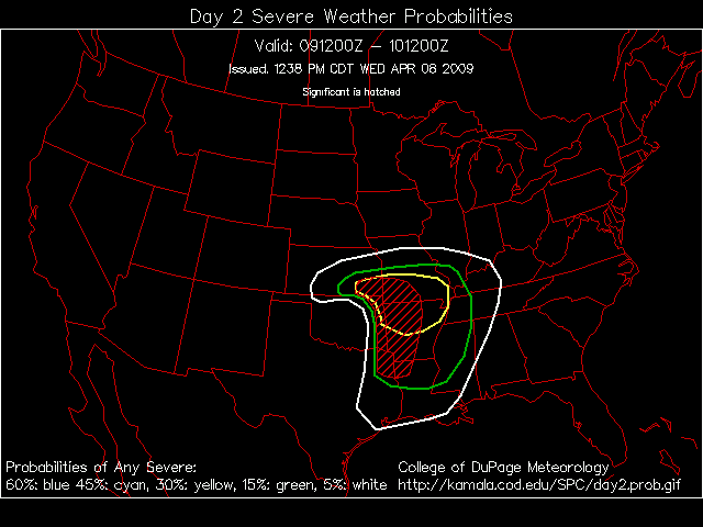
1. The entire area has been placed in a slight risk (remember there are three risk levels slight/moderate/high) for severe thunderstorms on Sunday, by the Storm Prediction Center
2. Storm mode – low topped supercells and lines of storms are possible on Sunday.  If instability can be realized the risk for severe weather will increase a bit.
3. Storm motion – storms will move towards the east/northeast at 45-55 mph.
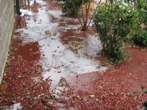
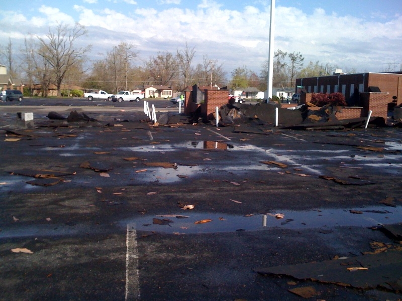
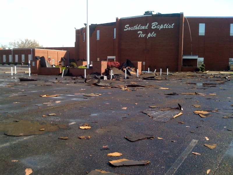
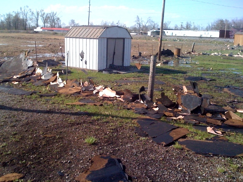
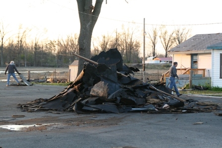
4. Severe weather type – large hail, damaging winds, heavy rain, lightning, and isolated tornadoes are possible Sunday.
5. Time – most likely time for severe weather will be between 11 AM and 7 PM.  (Some storms possible in the morning – esp in MO/IL)
The severe weather risk should diminish after sunset as the storms move further east.

ANALYSIS:

Remember that severe weather is isolated in nature.  Unless a major squall line pushes through a particular region the damage generally varies from county county.  A few counties may sustain large hail, damaging winds, or tornadoes and the majority of counties may not receive any severe weather.  It is nearly impossible to predict ahead of time which county will receive the worst weather.  Unlike snowstorms, severe thunderstorms can be isolated or scattered.

I say that only because the last few events have produced little damage in Massac, McCracken, Ballard, and Graves Counties.  Other counties have not been so fortunate.  It is the luck of the draw when it comes to these event as to who get hits and who does not.

This also makes it difficult it trying to keep the public vigilant during spring severe weather season.  It is "always" someone else’s county that is impacted, however we know that is now always the case.  All of our local counties have taken a beating over the last few years.  So, it is important to take each event on its own merit. 

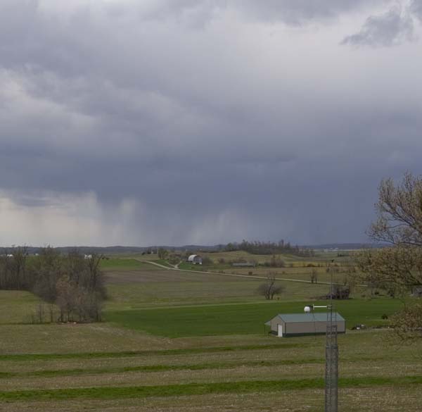
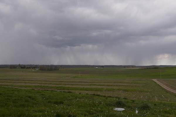
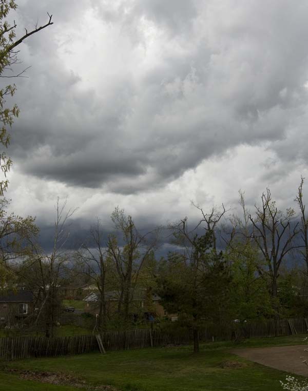
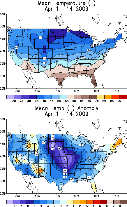
Strong low pressure area is advancing through Kansas and Missouri this morning.  It will continue to push eastward and southeastward through this afternoon.  Temperatures and dew points will increase across our region through the morning and early afternoon hours.  They should reach at least the 50s and some dew points could rise into the 60s.  This will provide enough moisture for severe thunderstorms to form.

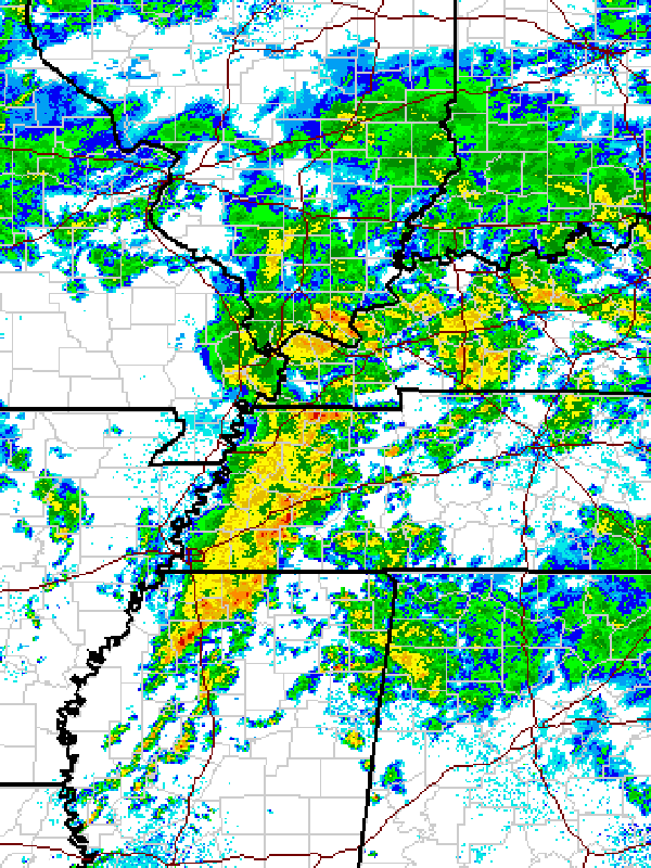
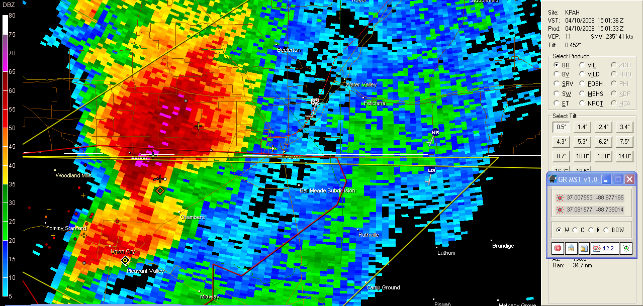
Thunderstorms – supercells will likely develop later this morning and during the afternoon hours over portions of Illinois, Indiana, Kentucky and Tennessee.  The greatest risk for tornadoes will likely be over Illinois and Indiana.  Tornadoes can not be ruled out over the rest of our counties, as well.  The main threat will likely be large hail and high winds.

A few thunderstorms will also move into the region this morning (before noon).  The main threat for these storms would be locally heavy downpours and hail.  You can see them forming on radar out in Missouri and Oklahoma, at this hour.  Lightning, of course, will also be a threat for those outdoors.

Very windy conditions (west/northwest winds) will also spread over the region later on Sunday and continue into Monday.  Wind gusts over 30 mph are likely – with gusts over 40 mph possible in open fields and on hilltops.  Cold weather will also spread over the region.  A rain/snow mixture is even possible on Monday as the colder air moves into the region.  No accumulation is expected.  A set-back for spring lovers.  Freezing temperatures will be possible on Tuesday morning, unfortunately.

Another storm will approach the region on Thursday.  A bit early to determine what if any severe weather threat will occur with this system.  Another storm system will approach the region next Sunday into Monday.  Timing of this system is very uncertain, however, severe weather will also be possible with it.

Active weather pattern. Stay tuned…

Again, in summary:

Some strong/severe storms are possible today – we are in a slight risk zone.
Windy conditions (west/northwest winds) on Sunday afternoon into Monday – gusts over 30 mph likely.
Cold weather returns on Sunday night and Monday.  Rain/snow mix is possible on Monday – windy, as well.  Cold Tuesday morning.
Some strong storms are possible next Thursday – uncertainty on track and instability surrounds that system.
Another storm system is possible for Easter and the following Monday/Tuesday time period.

———————————
———————————

LINKS FOR ADDITIONAL INFORMATION/RADAR/LIVE WEATHER:

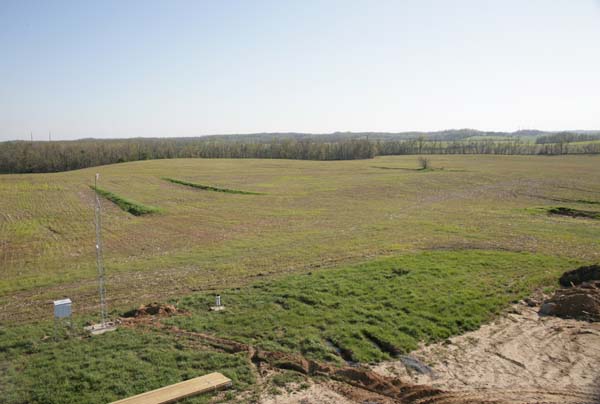
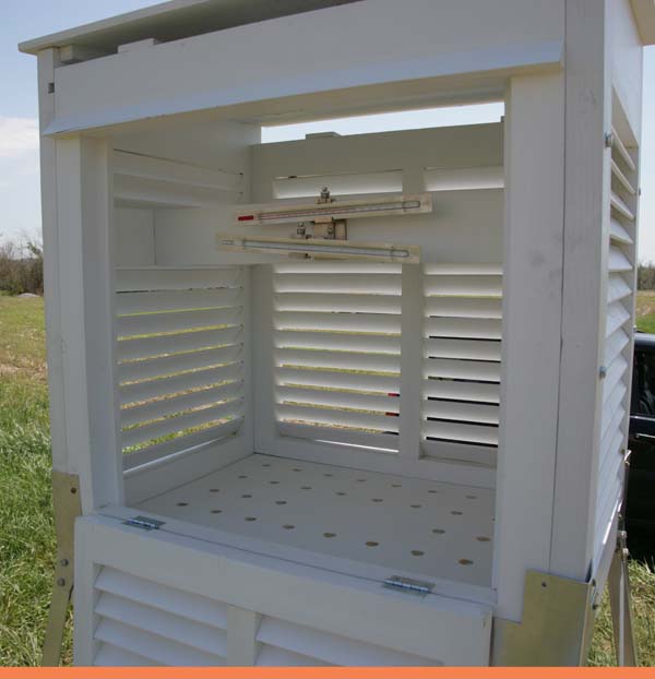
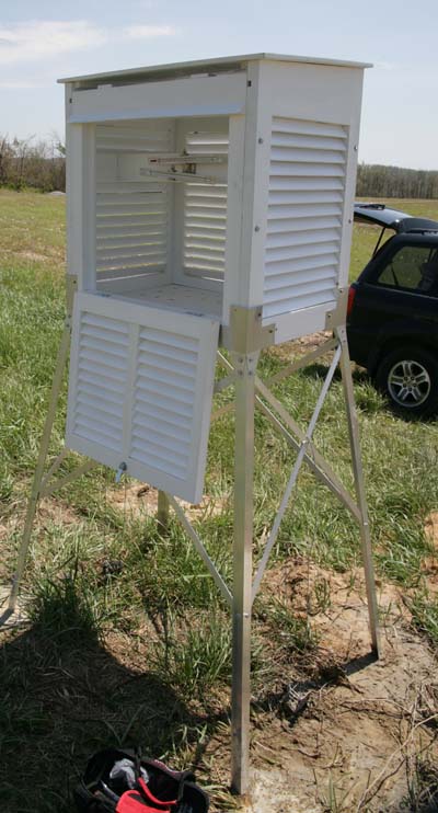
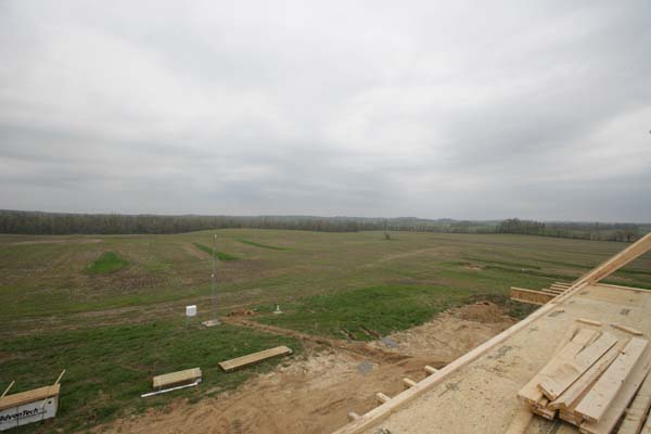
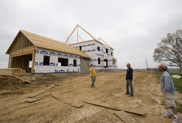
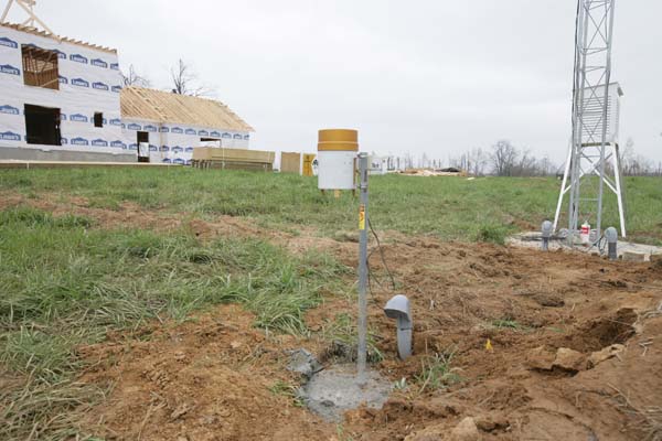
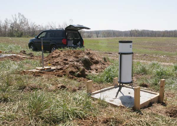
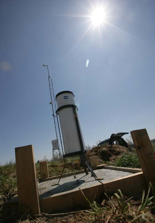
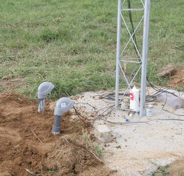
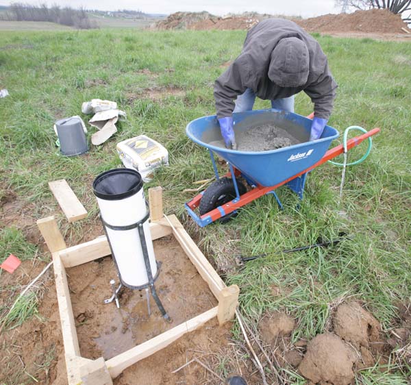
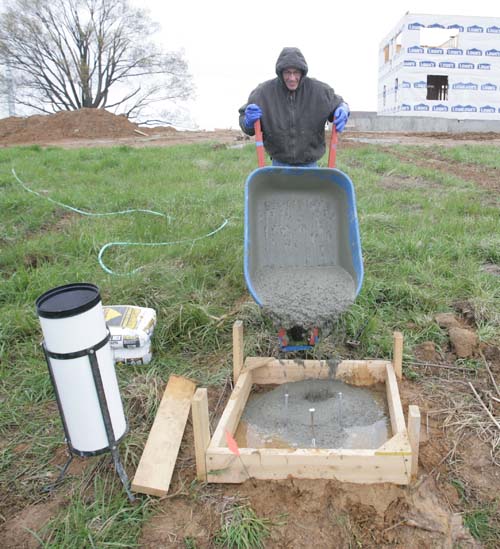
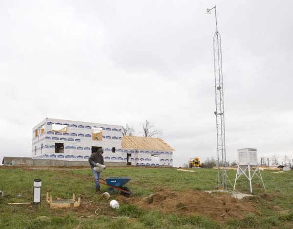
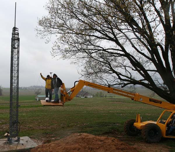
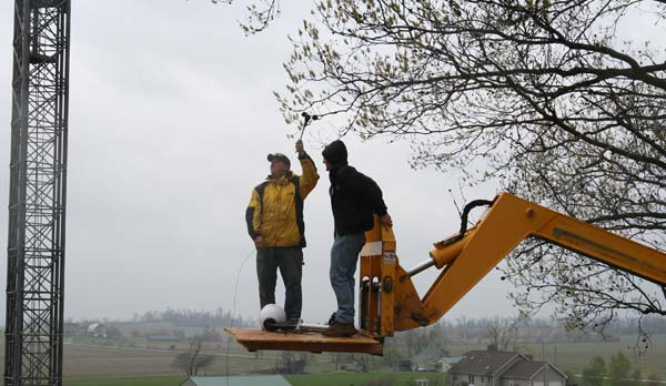
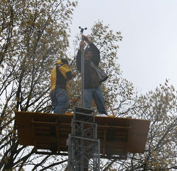
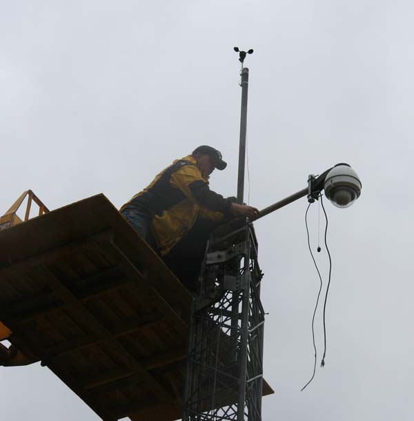
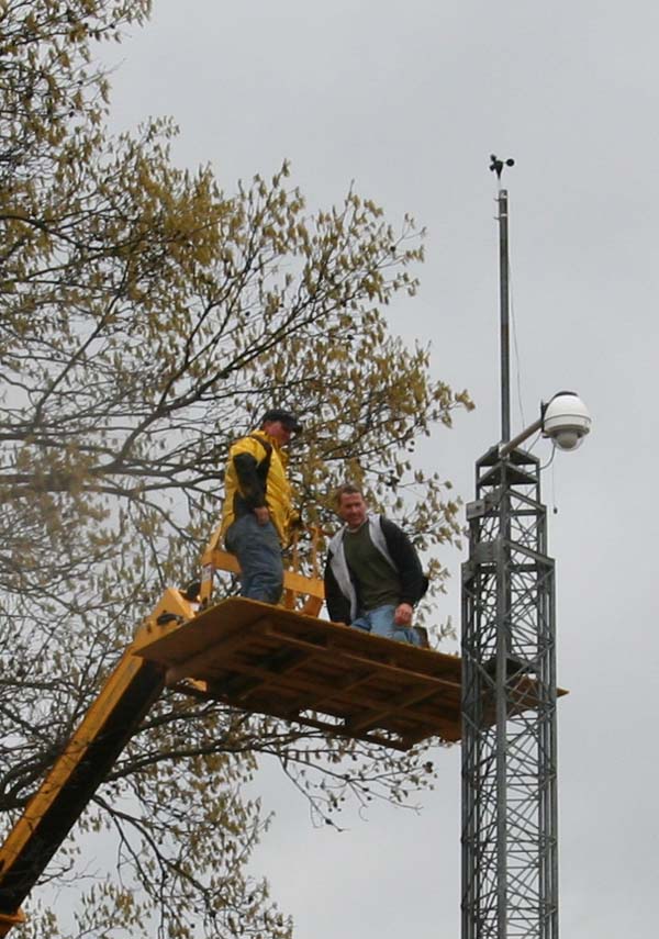
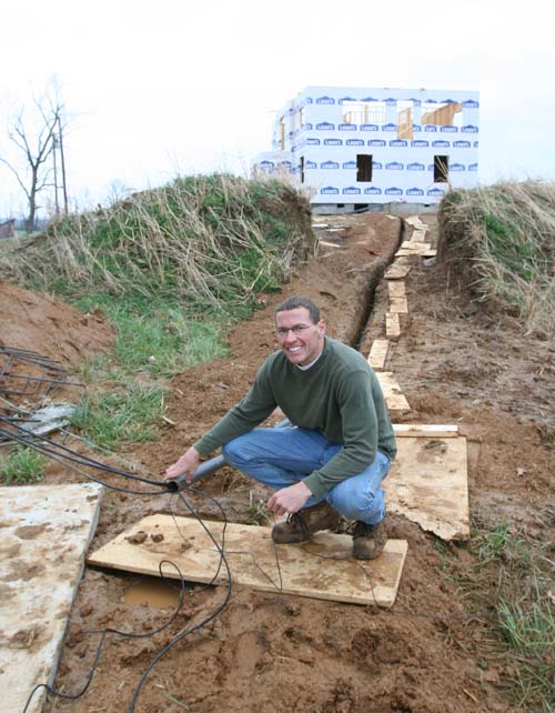
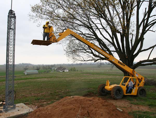
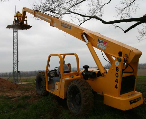
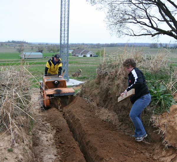
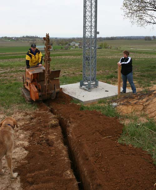
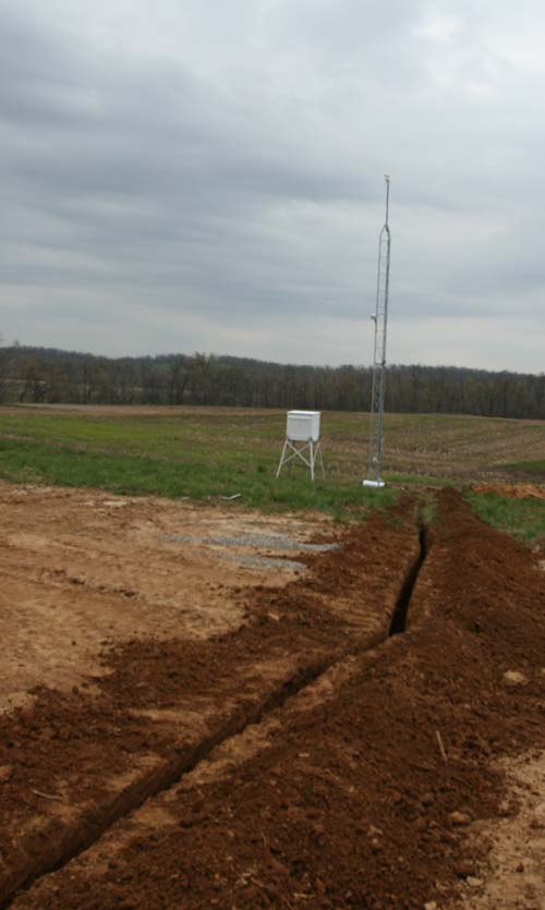
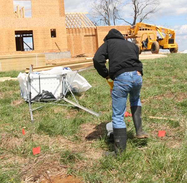
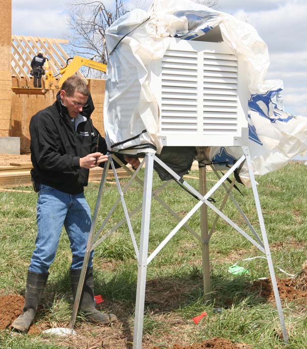
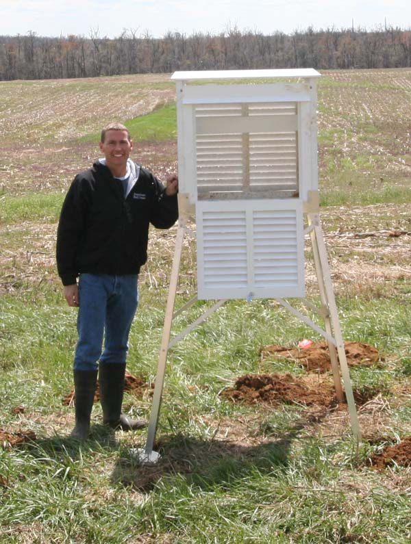
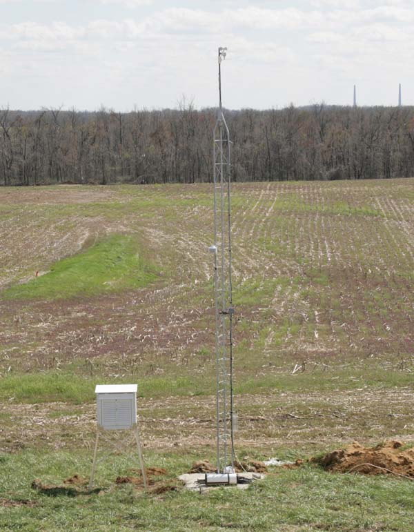
New weather stations are up in McCracken County (see links below)

We have placed two weather instruments systems up in McCracken County – the links are below:
http://www.wunderground.com/weatherstation/WXDailyHistory.asp?ID=KKYKEVIL2
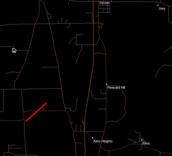
Western part of McCracken County (near Kevil in Ballard County)

http://www.wunderground.com/swf/Rapid_Fire.swf?units=english&station=KKYKEVIL2
Live streaming data of the above

http://www.wunderground.com/weatherstation/WXDailyHistory.asp?ID=KKYPADUC9
Reidland area

http://www.wunderground.com/swf/Rapid_Fire.swf?units=english&station=KKYPADUC9
Live streaming data from Reidland

You can find more stations on the Wunderground site (just put in your zip code).  Eventually I will have my system up and running in the Round Knob area of Massac County.  Will be a few more months, though.

Some links that might be useful:

Storm Prediction Web-Site
http://www.spc.noaa.gov/

Regional Radar
http://wxweb.meteostar.com/radar/radar_link.shtml?map=SCR_BASE_REFL.gif

Large Regional Radar
http://radar.weather.gov/Conus/full.php

National Weather Service Paducah – watches/warnings
http://www.crh.noaa.gov/pah/

National Weather Service Memphis, Tennessee – watches/warnings
http://www.srh.noaa.gov/meg/

All NWS Sites
http://www.weather.gov/organization.php#maps

Beau Dodson
Meteorological Specialist for the Paducah/McCracken County Office of Emergency Management

April 3, 2009: Rice Krispies Cereal! Disney toy inside.

  It is always the little things in life 🙂


I ended up with the Goofy toy 🙂

 And then Daisy decided she wanted it…


April 3, 2009: Daisy gets a bath :)

  Bath-day for Daisy 🙂 


She is NOT very happy 🙂

April 3, 2009: Friday – day after the rain – farm photos!

  Well, the sun was out today.  Actually a beautiful sky with some fair weather cumulus clouds.  Perfect temperatures.  It is actually going to be cold tonight.  A FROST ADVISORY 🙂 – imagine that – has been issued by the National Weather Service.  No surprise – we have had cold springs for the last few years.  It looks like temperatures will fall into the 30s.  Storms are possible on Sunday – few strong ones – then more cold weather into next week.  We could even experience a light freeze at the beginning of the week. 

  Jason Darnall fixed up my car this morning.  He installed the new emergency management radios and put in a computer/laptop console.  Fits on the passenger side of the car.  Now I can put my computer there when I am out chasing or at the farm.  🙂

  Went by the farm today.  They had some high winds because I could see the wood scatterered around on top of the garage.  No damage, though.  Probably had gusts over 40 mph, though.

  Lot of water standing – so we swept all of that out of the house.  Everything is water proof, but I still don’t like to see the water standing there.  🙂  We got that cleaned up.

  Probably one of our "bigger" tasks is trying to get a T-line up on the farm.  I am holding my breath and crossing my fingers that this works out.  This is our best option for high speed internet.  We shall see!  Tony is working hard on that project.  Hope it works out.

  Otherwise – everything else looks good.  House is coming along.  The "weather room" – "media room" window cut-outs appear to provide a GREAT view of the southern/western/northern sky.  I should be able to see storms coming with no problem!!!!

  Some highlights from today -losing my keys for awhile at the farm and spending an hour getting the garage door shut because the wheels came off of it.  🙂

  Some photos from today…


"Easter" flowers are blooming


She is rising out of the ground 🙂


Looking south out of the weather room


Looking southwest out of the weather room


South view from the weather room


Looking west/northwest out of the weather room


Nice sky today 🙂  – some wind blown wood


Second floor


Water water water


WHAT THE HECK IS THIS???????????  SPRING?????